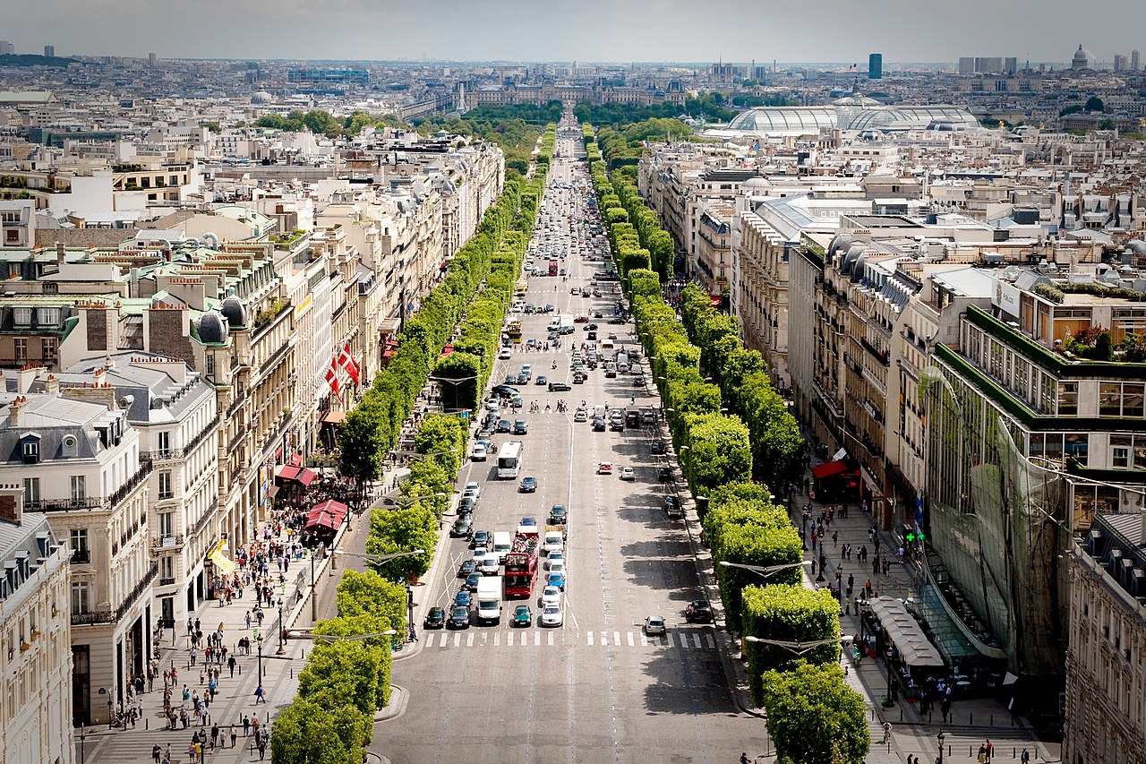
The historic axis, island to arch
One continuous line west from Île de la Cité to the Arc de Triomphe, following the axis that has organised the city for centuries.
Segments
-
 Île de la Cité & Notre-Dame
Saint-Michel–Notre-Dame → Notre-Dame de Paris
City streets and riverside
Begin on the island in the Seine where Paris was founded. Stand before the Gothic west front of Notre-Dame, reopened in December 2024 after the devastating 2019 fire, and cross the flower market before heading for the river. Allow about 45 minutes.
About this place
Notre-Dame de Paris, often referred to simply as Notre-Dame, is a medieval Catholic cathedral on the Île de la Cité, in the 4th arrondissement of Paris, France. It is the cathedral church of the Roman Catholic Archdiocese of Paris.
Read more on Wikipedia ↗Photo: Ali Sabbagh · CC0
-
 Across the Seine to the Louvre
Île de la Cité → Louvre (Cour Napoléon)
City streets
Cross the Pont Neuf, the oldest standing bridge in Paris, and follow the right bank to the Louvre — the world's largest and most-visited art museum, home to the Mona Lisa. Pause in the courtyard beneath I. M. Pei's glass pyramid. About 25 minutes plus museum time.
About this place
The Louvre is a national art museum in Paris, France. It is located on the Right Bank of the Seine in the city's 1st arrondissement (district) and home to some of the most canonical works of Western art, including the Mona Lisa, Venus de Milo, and Winged Victory. The museum is housed in the Louvre Palace, originally built in the late 12th to 13th century under Philip II. Remnants of the Medieval Louvre fortress are visible in the basement of the museum. Due to urban expansion, the fortress eventually lost its defensive function, and in 1546 Francis I converted it into the primary residence of the French kings.
Read more on Wikipedia ↗Photo: Benh LIEU SONG (Flickr) · CC BY-SA 3.0
-
 The Tuileries Garden
Louvre → Tuileries Garden (west end)
Gravel garden paths
Walk the length of the Tuileries, the formal garden laid out for Catherine de' Medici in 1564 and redesigned by André Le Nôtre. Gravel avenues, clipped hedges and round basins make it the classic Parisian promenade. About 25 minutes.
About this place
The Tuileries Garden is a public garden between the Louvre and the Place de la Concorde in the 1st arrondissement of Paris, France. Created by Catherine de' Medici as the garden of the Tuileries Palace in 1564, it was opened to the public in 1667 and became a public park after the French Revolution. Since the 19th century, it has been a place for Parisians to celebrate, meet, stroll and relax. Covering an area of 25.5 hectares, it is one of the most iconic parks in Paris. During the 2024 Summer Olympics and Paralympics, it was the site of the Olympic and Paralympic cauldron.
Read more on Wikipedia ↗Photo: Guilhem Vellut from Tokyo, Japan · CC BY 2.0
-
 Place de la Concorde
Tuileries Garden → Place de la Concorde
City square
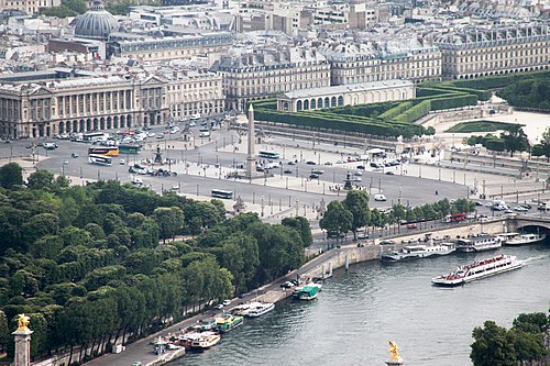
Step into the largest square in Paris, laid out in the 18th century and once the site of the Revolution's guillotine. At its centre stands the Luxor Obelisk, a 3,000-year-old gift from Egypt. About 20 minutes.
About this place
The Place de la Concorde, originally the Place Louis XV, and later the Place Louis XVI, is a public square in Paris. Measuring 7.6 ha in area, it is the largest square in the city. It is located in the 8th arrondissement, at the eastern end of the Champs-Élysées.
Read more on Wikipedia ↗Photo: Cristian Bortes from Cluj-Napoca, Romania · CC BY 2.0
- Up the Champs-Élysées
Place de la Concorde → Rond-Point / avenue des Champs-Élysées
Grand avenue
Climb the gentle rise of the Champs-Élysées, roughly 1.9 km of the world's most famous avenue — leafy and calm at its lower end, then a broad parade of cafés, flagship shops and theatres. About 40 minutes with stops.
-
 The Arc de Triomphe
Avenue des Champs-Élysées → Arc de Triomphe
City streets and rooftop terrace
End at the 50-metre arch commissioned by Napoleon in 1806 and completed in 1836, standing over the Tomb of the Unknown Soldier. Climb the 284 steps to the terrace for a sunset view down all twelve radiating avenues.
About this place
The Arc de Triomphe de l'Étoile, often simply called the Arc de Triomphe, is one of the most famous monuments in Paris, France. It is located at the western end of the Champs-Élysées, at the centre of the Place Charles de Gaulle—formerly known as the Place de l'Étoile—named for the star-shaped configuration formed by the convergence of twelve radiating avenues. The monument is situated at the intersection of three arrondissements: the 16th, the 17th, and the 8th. Commissioned to honor those who fought and died for France during the French Revolutionary and Napoleonic Wars, the Arc bears the names of French victories and generals engraved on its inner and outer surfaces. Beneath its vault lies the Tomb of the Unknown Soldier from World War I, marked by an eternal flame commemorating unidentified fallen soldiers.
Read more on Wikipedia ↗Photo: Jiuguang Wang · CC BY-SA 2.0