← All routes
Trek Pyrenees to Galicia — the French Way, France & Spain

The Camino Francés: Seven Iconic Stages to Santiago

A highlights walk along the famous French Way, from crossing the Pyrenees to the Iron Cross and Galicia's green hills, ending at the cathedral of Santiago de Compostela.

The Camino Francés: Seven Iconic Stages to Santiago
Photo: Manfred Zentgraf, Volkach, Germany · CC BY-SA 3.0
Duration
7 days
Distance
168 km
Ascent
2800 m
Difficulty
Moderate
Best season
Late spring to early autumn (May–September); avoid the Pyrenees crossing in winter

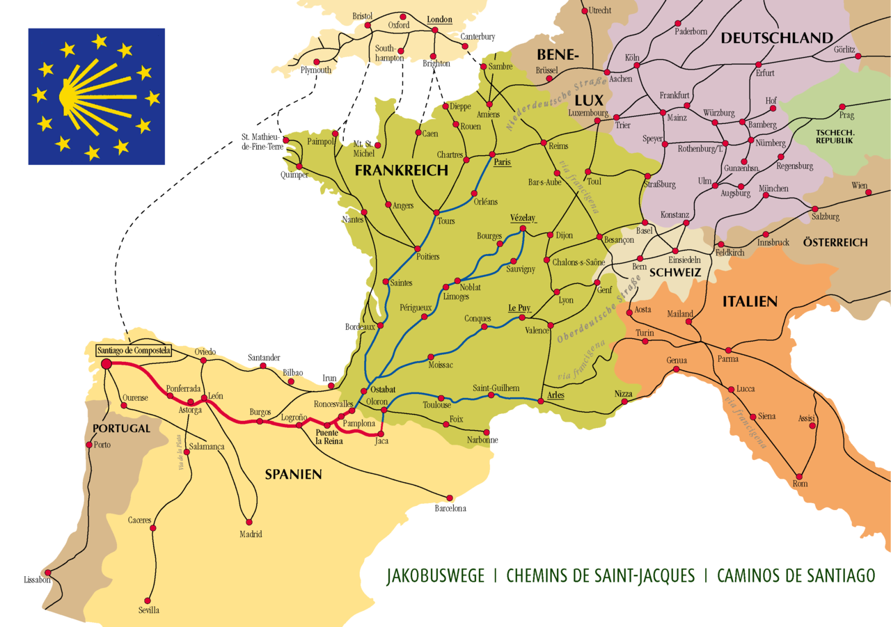
The Camino Francés is the most walked of all the pilgrim roads to Santiago — some 769 km from the French foothills of the Pyrenees across northern Spain to the tomb of Saint James. Walking the whole thing takes about a month, so this route pulls out seven of the most iconic stages, each a single day, so you can taste the Camino’s greatest hits: the high mountain crossing, the ridge of forgiveness, the Gothic cathedrals, the endless meseta, the Iron Cross, the misty gateway to Galicia, and the emotional arrival at the Obradoiro square.

These are sampled stages, not a continuous seven-day walk — pick them up as a taster, or string them into a longer pilgrimage.

Getting there. Most pilgrims start at Saint-Jean-Pied-de-Port, reached by train from Bayonne in France. Santiago has its own airport and rail connections. Between stages, Spain’s regional buses and trains link the major cities — Pamplona, Burgos, León, Ponferrada and Sarria.

Permits & the Compostela. No permit is needed to walk, but to receive the Compostela certificate in Santiago you must carry a credencial (pilgrim passport), stamp it twice a day over the final stretch, and cover at least the last 100 km on foot — which is why Sarria is the busiest starting point.

Good to know:

Day 1

Saint-Jean-Pied-de-Port to Roncesvalles

Saint-Jean-Pied-de-Port → Roncesvalles 25 km ↑ 1280 m

A big mountain crossing on the Route de Napoléon, climbing more than 1,200 m to the Col de Lepoeder before dropping through beech woods to the monastery village of Roncesvalles.

Segments

  1. Climb to Orisson
    Climb to Orisson 8 km ↑ 620 m

    Saint-Jean-Pied-de-Port → Refuge Orisson

    Steep mountain road

    Leave the walled Basque town through the Porte d'Espagne and climb hard on a narrow paved road, with the valley falling away behind you and the first big views of the Pyrenees ahead. About 2.5 hours to the last refuge before the border.

    About this place

    Saint-Jean-Pied-de-Port is a commune in the Pyrénées-Atlantiques department in south-western France. It is close to Ostabat in the Pyrenean foothills. The town is the old capital of the traditional Basque province of Lower Navarre. Saint-Jean-Pied-de-Port is the second most popular starting point of the French Way. It is a member of Les Plus Beaux Villages de France Association.

    Read more on Wikipedia ↗

    Photo: Hayden Soloviev · CC BY 4.0

  2. Over the high pass
    Over the high pass 10 km ↑ 660 m

    Refuge Orisson → Col de Lepoeder

    Open high mountain, grassland

    Continue up open grazing land past the wayside statue of the Virgin of Orisson and the Cruz de Thibault, crossing into Spain at the Col de Lepoeder at about 1,450 m — the roof of the day. Around 3 hours; exposed to weather, with no shelter.

    About this place

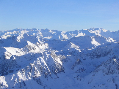
    The Pyrenees is a mountain range in southwestern Europe, straddling the France–Spain border. The Pyrenees extend nearly 500 kilometres (310 mi) from their union with the Cantabrian Mountains to Cap de Creus on the Mediterranean coast, reaching a maximum elevation of 3,404 metres (11,168 ft) at the peak of Aneto, in Huesca, Spain.

    Read more on Wikipedia ↗

    Photo: The original uploader was Nhamblen at English Wikipedia. · CC BY-SA 3.0

  3. Descent to Roncesvalles
    Descent to Roncesvalles 7 km ↑ 0 m

    Col de Lepoeder → Roncesvalles

    Steep beech-forest path

    Drop steeply through ancient beech forest to the great Augustinian monastery at Roncesvalles, gateway of the Camino in Spain and site of the legendary battle of 778. About 1.5 hours down.

    About this place

    Roncesvalles is a small village and municipality in Navarre, northern Spain. It is situated on the small river Urrobi at an altitude of some 900 metres (3,000 ft) in the Pyrenees, about 4 kilometres (2.5 mi) from the French border as the crow flies, or 21 kilometres (13 mi) by road.

    Read more on Wikipedia ↗

    Photo: Hayden Soloviev · CC BY 4.0

Day 2

Pamplona to Puente la Reina

Pamplona → Puente la Reina 24 km ↑ 380 m

A gentle rural stage rising to the Alto del Perdón, its ridge lined with iron pilgrim sculptures and wind turbines, then descending through vineyards to the Queen’s Bridge where the French and Aragonese ways unite.

Segments

  1. Leaving Pamplona
    Leaving Pamplona 9 km ↑ 150 m

    Pamplona old town → Zariquiegui

    City streets then farm track

    Cross the university city made famous by Hemingway and the running of the bulls, then climb gently through wheat fields toward the hill village of Zariquiegui. About 2.5 hours.

    About this place

    Pamplona, historically also known as Pampeluna in English, is the capital city of the Chartered Community of Navarre in Spain. As of 2024, with a population of 208,243, it is the 29th largest city in Spain.

    Read more on Wikipedia ↗

    Photo: José Luis Filpo Cabana · CC BY-SA 4.0

  2. The Alto del Perdón 3 km ↑ 230 m

    Zariquiegui → Alto del Perdón

    Steady ridge climb

    Climb to the crest of the Sierra del Perdón at about 770 m, where a line of rusted-iron pilgrim figures leans into the wind beneath the turbines — one of the Camino's signature images. Around 1 hour.

  3. Down to the Queen's Bridge
    Down to the Queen's Bridge 12 km ↑ 0 m

    Alto del Perdón → Puente la Reina

    Loose descent then vineyard tracks

    Descend a stony path and roll through vineyards and the villages of Uterga and Óbanos to Puente la Reina, named for its elegant six-arched Romanesque bridge built for pilgrims. About 2.5 hours.

    About this place

    Puente la Reina is a town and municipality located in the autonomous community of Navarre, in northern Spain.

    Read more on Wikipedia ↗

    Photo: Piotr Tysarczyk · CC BY-SA 3.0

Day 3

Burgos onto the Meseta

Burgos → Hornillos del Camino 21 km ↑ 150 m

Leave the city of Burgos along the Arlanzón river, then climb onto the meseta — the wide, treeless tableland that tests pilgrims with its silence and space — to the small stone village of Hornillos del Camino.

Segments

  1. Out of Burgos
    Out of Burgos 10 km ↑ 20 m

    Burgos Cathedral → Tardajos

    Riverside parks and lanes

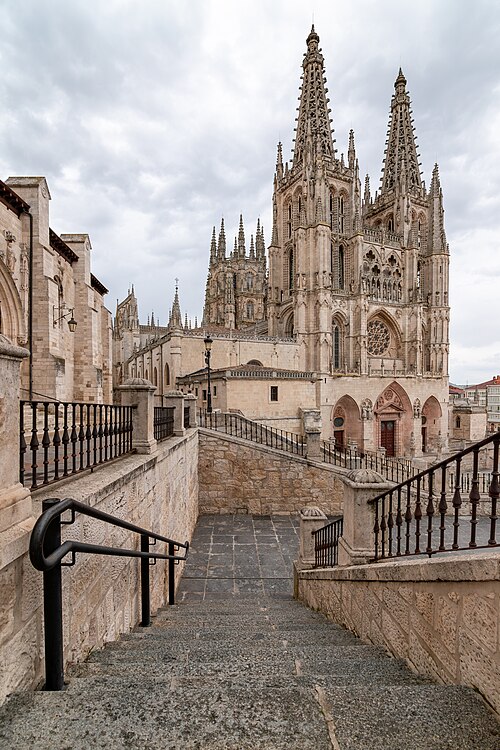
    Set off beneath the soaring spires of Burgos Cathedral, a UNESCO-listed masterpiece of Spanish Gothic, and follow green riverside paths out of the city to the village of Tardajos. About 2.5 hours.

    About this place

    The Cathedral of Saint Mary of Burgos is a Catholic church dedicated to the Virgin Mary located in the historical center of the Spanish city of Burgos. Its official name is the Holy Metropolitan Cathedral Basilica Church of St Mary of Burgos.

    Read more on Wikipedia ↗

    Photo: José Ligero Loarte · CC BY-SA 4.0

  2. Up onto the plateau
    Up onto the plateau 11 km ↑ 130 m

    Tardajos → Hornillos del Camino

    Dirt track across open meseta

    Climb a ramp onto the meseta and walk a dead-straight track across huge cereal fields with nothing but sky for company, dropping at last into the honey-coloured hamlet of Hornillos. About 2.5 hours.

    About this place

    The Meseta Central is one of the basic geographical units of the Iberian Peninsula. It consists of a plateau covering a large part of the latter's interior.

    Read more on Wikipedia ↗

    Photo: Nicolás Pérez · CC BY-SA 3.0

Day 4

León to Hospital de Órbigo

León → Hospital de Órbigo 32 km ↑ 130 m

A long, flat plains stage leaving the great city of León and its stained-glass cathedral, crossing the dry páramo to the long stone bridge of Hospital de Órbigo, scene of a legendary 15th-century tournament.

Segments

  1. León's cathedral city
    León's cathedral city 8 km ↑ 90 m

    León Cathedral → La Virgen del Camino

    City streets and suburbs

    Begin at the León Cathedral, whose walls are famously more glass than stone, then thread out through the suburbs to the modern pilgrim sanctuary of La Virgen del Camino. About 2 hours.

    About this place

    Santa María de Regla de León Cathedral is a Catholic church, the episcopal see of the diocese of León in the city of León, Castile and León, north-western Spain, consecrated under the name of the Virgin Mary. It was the first monument declared by the Royal Order of Spain on 28 August 1844.

    Read more on Wikipedia ↗

    Photo: David Jiménez Llanes · CC BY-SA 3.0

  2. Across the páramo 13 km ↑ 20 m

    La Virgen del Camino → Villadangos del Páramo

    Flat gravel path beside the road

    A long, straight stretch across the flat farming plain of the páramo, following a path beside the main road to the roadside village of Villadangos. About 3 hours.

  3. To the Órbigo bridge 11 km ↑ 20 m

    Villadangos del Páramo → Hospital de Órbigo

    Field paths and a great stone bridge

    Cross fields to Hospital de Órbigo and its remarkable long medieval bridge, the Passo Honroso, where a knight held a jousting challenge in the Holy Year of 1434. About 2.5 hours.

    About this place

    Hospital de Órbigo is a municipality located in the province of León, Castile and León, Spain. According to the 2010 census (INE), the municipality had a population of 1,031 inhabitants.

    Read more on Wikipedia ↗
Day 5

Foncebadón to Ponferrada

Foncebadón → Ponferrada 27 km ↑ 180 m

From the mountain hamlet of Foncebadón the path climbs to the Cruz de Ferro, where pilgrims leave a stone carried from home, then makes a long, steep drop through slate villages of the Bierzo to the Templar town of Ponferrada.

Segments

  1. To the Iron Cross
    To the Iron Cross 2 km ↑ 80 m

    Foncebadón → Cruz de Ferro

    Mountain path

    A short climb from Foncebadón to the Cruz de Ferro, a simple iron cross on a tall pole atop a great mound of stones — the most moving ritual stop on the Camino, and near the route's highest ground at about 1,500 m. Around 40 minutes.

    About this place

    Foncebadón is a Spanish village in the municipality of Santa Colomba de Somoza, in the province of León.

    Read more on Wikipedia ↗

    Photo: Rodelar · CC BY-SA 3.0

  2. Down through the Bierzo
    Down through the Bierzo 8 km ↑ 40 m

    Cruz de Ferro → El Acebo

    Rocky ridge and steep descent

    Pass the near-abandoned outpost of Manjarín and begin a long, rough descent along the ridge to the slate-roofed mountain village of El Acebo, with the Bierzo valley opening below. About 2.5 hours.

    About this place

    El Bierzo is a comarca in the province of León, Spain. Its capital is the town of Ponferrada. Other major towns are Bembibre and Villafranca del Bierzo, the historical capital.

    Read more on Wikipedia ↗

    Photo: Fogar Mozárabe · CC BY-SA 4.0

  3. To Molinaseca
    To Molinaseca 8 km ↑ 20 m

    El Acebo → Molinaseca

    Steep stony descent

    Keep dropping steeply to the pretty riverside town of Molinaseca, where pilgrims cool their feet in the Meruelo beneath a fine medieval bridge. About 2 hours.

    About this place

    Molinaseca is a village and municipality located in the region of El Bierzo. According to the 2010 census (INE), the municipality has a population of 818 inhabitants. It is located on the French Way, the most popular path of the Camino de Santiago.

    Read more on Wikipedia ↗

    Photo: José Antonio Gil Martínez from Vigo, Spain · CC BY 2.0

  4. Into Ponferrada 9 km ↑ 40 m

    Molinaseca → Ponferrada

    Town roads and paths

    Walk the final easy stretch into Ponferrada, dominated by its huge 12th-century Templar castle guarding the river Sil. About 2 hours.

Day 6

O Cebreiro to Triacastela

O Cebreiro → Triacastela 21 km ↑ 300 m

One of the most atmospheric stages, high on the ridge that marks the entry into Galicia at O Cebreiro with its Celtic-style pallozas, then over two small passes and down through chestnut woods to Triacastela.

Segments

  1. The Galician ridge
    The Galician ridge 9 km ↑ 250 m

    O Cebreiro → Alto do Poio

    High ridge track

    Start in the mist at O Cebreiro, famous for its pre-Roman round-stone pallozas and its miracle church, and follow the ridge past the pilgrim statue at Alto de San Roque to the high point of Alto do Poio at about 1,335 m. Around 2.5 hours.

    About this place

    Pedrafita do Cebreiro is a municipality in the province of Lugo in Galicia, Spain. It borders the Lugo municipalities of As Nogais, Cervantes, Folgoso do Courel, Samos and Triacastela. Its eastern boundary borders the province of León. It belongs to the comarca of Os Ancares.

    Read more on Wikipedia ↗

    Photo: Bjørn Christian Tørrissen · CC BY-SA 3.0

  2. Down to Fonfría 6 km ↑ 20 m

    Alto do Poio → Fonfría

    Rolling farm lanes

    Descend through tiny Galician hamlets and green pasture, with wide views over layered blue hills, to the village of Fonfría. About 1.5 hours.

  3. Into Triacastela
    Into Triacastela 6 km ↑ 30 m

    Fonfría → Triacastela

    Sunken lanes through chestnut woods

    Drop through ancient chestnut woods and stone-walled lanes to Triacastela, a classic Camino stop in a quiet valley. About 1.5 hours.

    About this place

    Triacastela is a municipality in the province of Lugo, Galicia, Spain. It gets its name from the three castles that once stood here, none of which exist today. Norman (Viking) invaders pillaged here in 968 A.D., but were eventually defeated at Cebreiro pass and driven off. They probably destroyed all three castles at that time.

    Read more on Wikipedia ↗

    Photo: Jule_Berlin · CC BY 2.0

Day 7

Into Santiago de Compostela

O Pedrouzo → Santiago de Compostela 20 km ↑ 350 m

The last walk into Santiago, through fragrant eucalyptus forest and the outskirts of the city to Monte do Gozo — where pilgrims first glimpse the spires — and down into the old town to the cathedral and the Praza do Obradoiro.

Segments

  1. Through the eucalyptus 10 km ↑ 150 m

    O Pedrouzo → Lavacolla

    Forest and woodland paths

    Set off early through tall eucalyptus woods and rolling countryside, passing the airport, to Lavacolla, where medieval pilgrims washed before entering the holy city. About 2.5 hours.

  2. The Hill of Joy
    The Hill of Joy 5 km ↑ 120 m

    Lavacolla → Monte do Gozo

    Suburban rise

    Climb gently to Monte do Gozo, the 'Hill of Joy', where after weeks of walking pilgrims catch their first sight of the cathedral spires across the city. About 1.5 hours.

    About this place

    Monte do Gozo is a hill in Santiago de Compostela, Galicia, Spain. It is known for being the place where Christian pilgrims on the Camino de Santiago can get their first views of the three spires of their destination, the Cathedral of Santiago de Compostela. At 370 metres (1,210 ft), it could be the pilgrims' last hill and optional last stop before reaching the cathedral, with between one and two hours' walk still to go, and by tradition is where they cried out in rapture at finally seeing the end of their path.

    Read more on Wikipedia ↗

    Photo: Antoine Cadotte · CC BY-SA 3.0

  3. To the cathedral
    To the cathedral 5 km ↑ 40 m

    Monte do Gozo → Praza do Obradoiro

    City streets

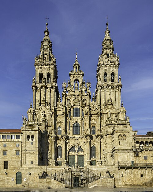
    Descend into Santiago and wind through the stone streets of the old town to the vast Praza do Obradoiro, ending beneath the baroque façade of the cathedral that holds the tomb of Saint James — journey's end. About 1.5 hours.

    About this place

    The Santiago de Compostela Archcathedral Basilica is part of the Metropolitan Archdiocese of Santiago de Compostela and is an integral component of the Santiago de Compostela World Heritage Site in Galicia, Spain. The cathedral is the reputed burial place of Saint James the Great, one of the apostles of Jesus Christ. It is also among the remaining churches in the world built over the tomb of an apostle, the other ones being St Peter's Basilica in Vatican City, St Thomas Cathedral Basilica in Chennai, India, and Basilica of St. John in İzmir, Turkey.

    Read more on Wikipedia ↗

    Photo: Fernando · CC BY-SA 4.0